India’s quick commerce industry has transformed the way consumers shop. Whether it’s groceries, medicines, electronics, or daily essentials, customers now expect deliveries within minutes rather than days.
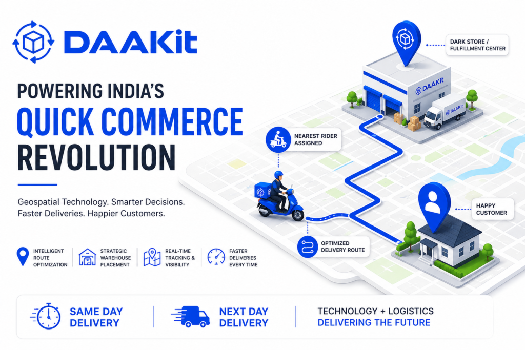
While most people associate quick commerce with delivery riders, dark stores, and lightning-fast delivery promises, the real engine behind this ecosystem is something far less visible—geospatial technology.
Every successful delivery depends on accurate location data, intelligent route planning, and real-time decision-making. As quick commerce expands beyond metropolitan cities into Tier-2 and Tier-3 markets, geospatial technology is becoming one of the most important pillars of modern logistics.
In this guide, we’ll explore how geospatial technology works, why it’s essential for quick commerce, and how it is shaping the future of logistics in India.
What is Geospatial Technology?
Geospatial technology refers to digital technologies that collect, analyze, and visualize location-based information. It combines multiple technologies, including:
- Geographic Information Systems (GIS)
- Global Positioning System (GPS)
- Digital Mapping
- Satellite Imagery
- Real-Time Traffic Data
- IoT Sensors
- Artificial Intelligence
Together, these technologies help businesses understand where people, products, vehicles, and warehouses are located and determine the most efficient way to move goods from one location to another.
For logistics companies, location data has become just as valuable as inventory data.
Why Geospatial Technology Matters in Quick Commerce
Every quick commerce order starts with a simple question:
“How can this order reach the customer in the shortest possible time?”
Answering that question requires dozens of location-based decisions in just a few seconds.
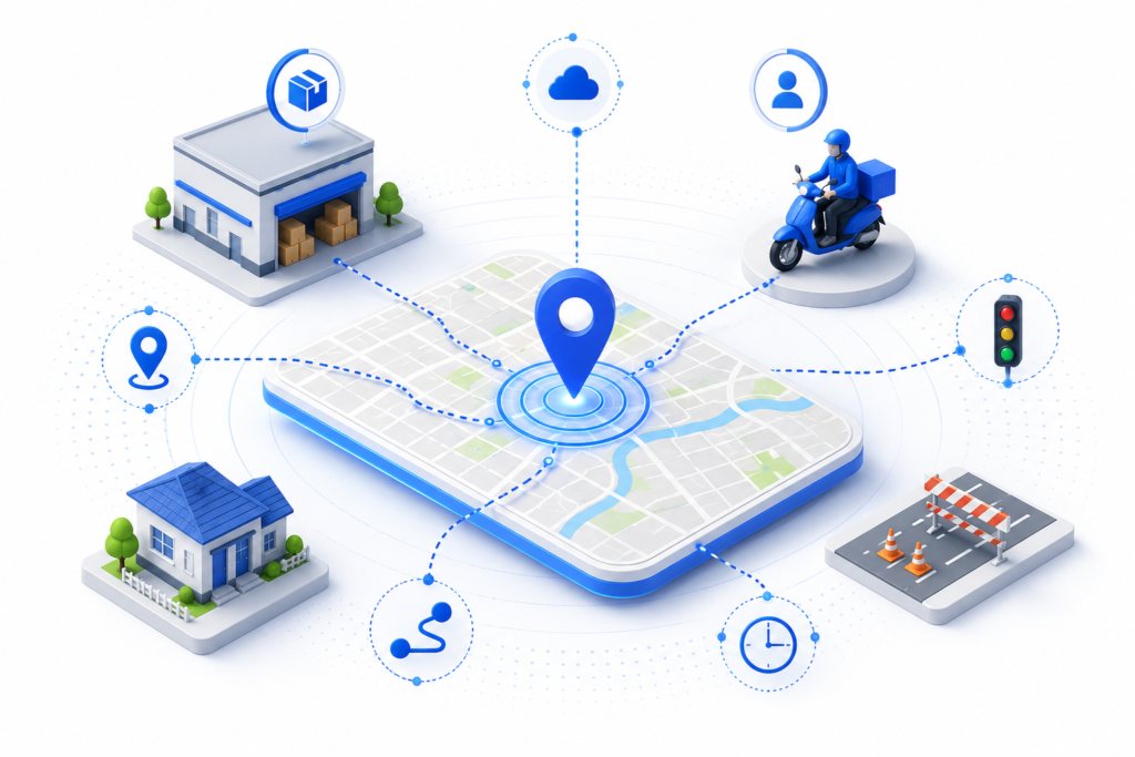
The system must determine:
- Where the customer is located
- Which fulfillment center has the product
- Which delivery partner is nearest
- Current traffic conditions
- Road closures or diversions
- Expected delivery time
- Serviceable delivery radius
Without intelligent location analysis, achieving 10 to 30-minute deliveries would be nearly impossible.
How Geospatial Technology Works in Quick Commerce
Let’s understand this with a simple example.
Imagine a customer in Gurugram orders protein powder through a quick commerce platform.
Within seconds, the platform:
- Identifies the customer’s exact location.
- Finds the nearest dark store with available inventory.
- Checks live traffic conditions.
- Selects the closest delivery rider.
- Calculates the fastest delivery route.
- Predicts an accurate ETA.
- Continuously updates the route if traffic changes.
All these actions happen automatically using geospatial technology before the rider even starts the delivery.
Key Benefits of Geospatial Technology in Logistics
1. Intelligent Route Optimization
Dynamic route optimization helps logistics companies identify the fastest and most fuel-efficient routes.
Benefits include:
- Faster deliveries
- Lower fuel consumption
- Reduced operational costs
- Improved rider productivity
- Better on-time delivery rates
Instead of following fixed routes, drivers receive optimized routes based on real-time road conditions.
2. Smarter Dark Store Placement
Quick commerce depends heavily on strategically located dark stores.
Geospatial analytics helps businesses identify:
- High-demand neighborhoods
- Customer density
- Order hotspots
- Delivery coverage gaps
- Population growth trends
This enables companies to establish fulfillment centers where they can serve the largest number of customers in the shortest time.
3. Better Delivery Zone Planning
Not every location can be served within a 10-minute delivery window.
Geospatial mapping helps companies define delivery boundaries based on:
- Distance
- Road connectivity
- Average travel time
- Rider availability
- Traffic patterns
This creates realistic service areas and improves delivery reliability.
4. Accurate Address Verification
Address inaccuracies remain a major challenge, especially in rapidly growing cities and semi-urban areas.
Location intelligence helps verify addresses using:
- GPS coordinates
- Landmark mapping
- Pin-code validation
- Digital mapping systems
This reduces failed deliveries and improves customer satisfaction.
5. Real-Time Shipment Tracking
Modern customers expect complete visibility into their orders.
Geospatial technology enables:
- Live rider tracking
- Estimated delivery times (ETA)
- Route monitoring
- Delay notifications
- Delivery confirmations
This transparency improves customer trust and reduces support inquiries.
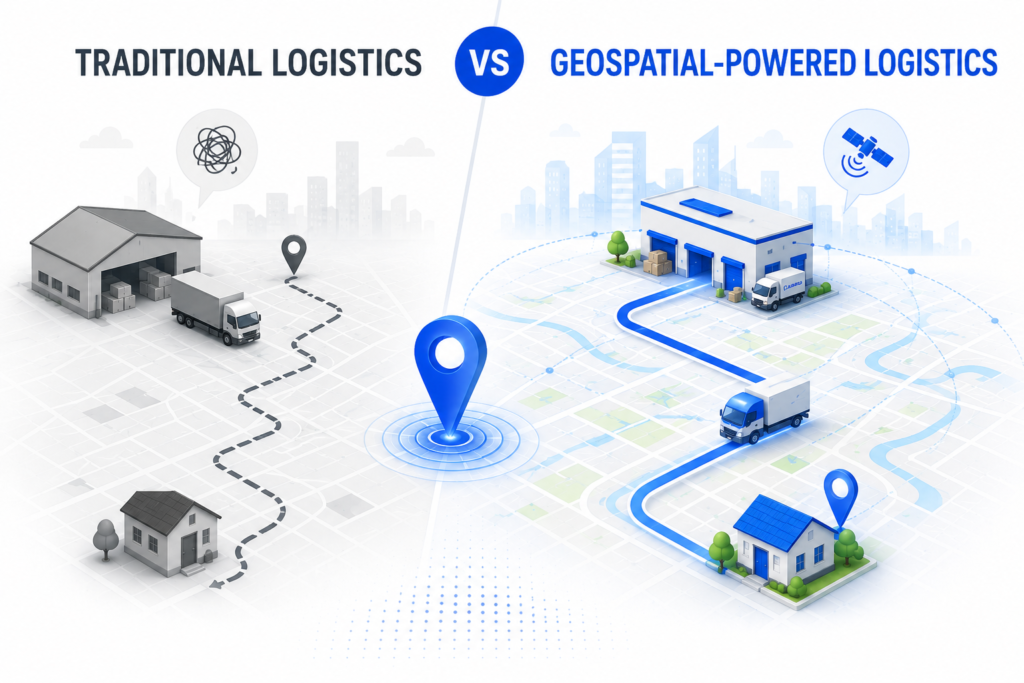
Traditional Logistics vs Geospatial-Powered Logistics
| Traditional Logistics | Geospatial-Powered Logistics |
|---|---|
| Static delivery routes | Dynamic route optimization |
| Manual planning | AI-driven location intelligence |
| Fixed delivery zones | Smart geofencing |
| Higher delivery failures | Accurate address verification |
| Slower ETA updates | Real-time tracking |
| Reactive decision-making | Predictive logistics |
Why Geospatial Technology is Critical for India's Growing Quick Commerce Market
India’s quick commerce expansion is no longer limited to cities like Delhi, Mumbai, Bengaluru, and Hyderabad.
Growth is increasingly driven by Tier-2 and Tier-3 cities, where logistics challenges include:
- Inconsistent address formats
- Rapid urban expansion
- Changing road networks
- Uneven delivery density
- Traffic variability
These markets require intelligent mapping systems that adapt quickly to changing environments.
Geospatial technology helps businesses expand confidently into new regions while maintaining high delivery standards.
The Hidden Infrastructure Behind Every Delivery
Consumers see a rider arriving with their package.
Behind the scenes, thousands of location-based calculations take place every second.
These include:
- Warehouse selection
- Inventory allocation
- Rider assignment
- Route optimization
- Traffic monitoring
- ETA prediction
- Delivery tracking
This invisible digital infrastructure ensures that every order reaches the customer as quickly and efficiently as possible.
The Future of Geospatial Technology in Quick Commerce
The next generation of logistics will rely even more heavily on location intelligence.
Emerging technologies include:
- AI-powered demand forecasting
- Predictive delivery routing
- Drone-assisted deliveries
- Autonomous delivery vehicles
- Digital twins for logistics networks
- Smart city integrations
- Real-time geofencing
- Hyperlocal demand heat maps
As these technologies mature, geospatial intelligence will become even more central to logistics operations.
Conclusion
Quick commerce is often viewed as a logistics challenge, but at its core, it is a location intelligence challenge.
As customer expectations continue to rise, businesses need more than warehouses and delivery fleets. They need intelligent infrastructure capable of understanding, analyzing, and optimizing location data in real time.
Geospatial technology is making this possible by enabling smarter routing, better warehouse placement, accurate serviceability mapping, and seamless last-mile deliveries.
At DAAKit, we believe the future of logistics will be powered by technology, automation, and data-driven decision-making. By combining intelligent fulfillment with advanced location intelligence, businesses can deliver faster, operate more efficiently, and scale confidently across India’s rapidly evolving commerce landscape.
As quick commerce continues to grow, the companies that harness the power of geospatial technology today will be the ones leading tomorrow’s logistics ecosystem.